 found via Kottke
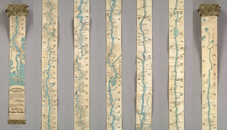
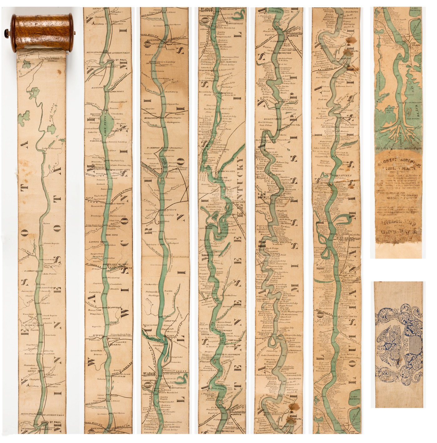
“Coloney and Fairchild’s patented apparatus required that the single sheet be cut into strips, attached end-to-end, mounted on linen, and then rolled inside a wooden, metal, or paper spool (fig. 4). The resulting portability of the map was crucial because, as advertisements indicated, it was intended for business travelers, steamboat navigators, and tourists. Of this form, the Newberry Library and the Minnesota Historical Society Library hold what seems to be a first edition, while nearly a dozen archives around the U.S. hold an updated second version. With the addition of hundreds of towns, mile markers, islands, landings, landowner and plantation names, and significant Civil War locations, the Lower Mississippi appears to be a settled and thriving commercial space.”
Larger versions of the image can be found here.